Sussex Inlet One Tree Bay West
Overview
- Size: 257.22 hectares
- Location: approx. 2 kilometres west of Sussex Inlet, Shoalhaven LGA, NSW south coast
The site occurs entirely within the Jervis sub-region of the Southern Rivers Major Catchment Area and the Jervis IBRA sub-region of the Sydney Basin IBRA region. The majority of the site is located within the Wandandian Coastal Plains Mitchell Landscape.
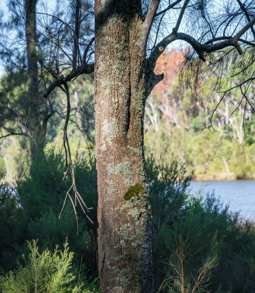
Sealark’s One Tree Bay West biodiversity site captures the natural beauty of St Georges Basin with scenic water views, large trees and diverse native vegetation communities.
The site is a forested peninsula surrounded by healthy estuarine waterways and drained by freshwater streams with largely unmodified fringing riparian and shoreline vegetation, extending into St Georges Basin and bordered by large rural lots in the west and south.
It is located along the foreshores of Swan Bay and One Tree Bay, which are part of St Georges Basin, with an eastern-most point called Bonito Point. The foreshores of two sheltered estuary bays form the northern and eastern boundaries, while the south and western boundaries adjoin rural lots which back on to Sussex Inlet Road and Hoskings Court and comprise a mixture of cleared and vegetated lands.
In the broader landscape, the One Tree Bay West biodiversity site is contiguous with extensive tracts of native vegetation and local conservation areas such as Conjola Lake National Park and Cooramy Regional Park.
Flora
Booroowungan Creek effectively splits the smaller southern portion from the larger northern portion of the site and exits into One Tree Bay. This sheltered bay is located between the southern foreshore of the One Tree Bay West biodiversity site and One Tree Bay East biodiversity site, both owned by Sealark.
Swan Bay is located between the northern foreshore of the site and the Tullarwalla biodiversity site is to the west. Seven plant community types (PCTs) have been identified on the site:
- Forest Red Gum – Thin-leaved Stringybark grassy woodland on coastal lowlands, southern Sydney Basin Bioregion (PCT 838)
- Needlebush – Banksia wet heath on sandstone plateaux of the Sydney Basin Bioregion (PCT 978)
- Red Bloodwood – Blackbutt – Spotted Gum shrubby open forest on coastal foothills, southern
- Sydney Basin Bioregion (PCT 1079) Red Bloodwood – Hard-leaved Scribbly Gum – Silvertop Ash heathy open forest on sandstone plateaux of the lower Shoalhaven Valley, Sydney Basin Bioregion (PCT 1082)
- Swamp Mahogany swamp sclerophyll forest on coastal lowlands of the Sydney Basin Bioregion and South East Corner Bioregion (PCT 1231)
- Swamp Oak swamp forest fringing estuaries, Sydney Basin Bioregion and South East Corner Bioregion (PCT 1234)
- Swamp Paperbark – Swamp Oak tall shrubland on estuarine flats, Sydney Basin Bioregion and South East Corner Bioregion (PCT 1236).
There are two threatened ecological communities (EEC) under the NSW Threatened Species Conservation Act 1995 mapped within the site. One of the EECs, Swamp Oak Floodplain Forest of the NSW North Coast, Sydney Basin and South East Corner bioregions is represented by two different PCTs (PCT 1234 and PCT 1236). The other EEC is Swamp Sclerophyll Forest on the Coastal Floodplains of the New South Wales North Coast, Sydney Basin and South East Corner Bioregions EEC, which is represented by PCT 1231.

Fauna
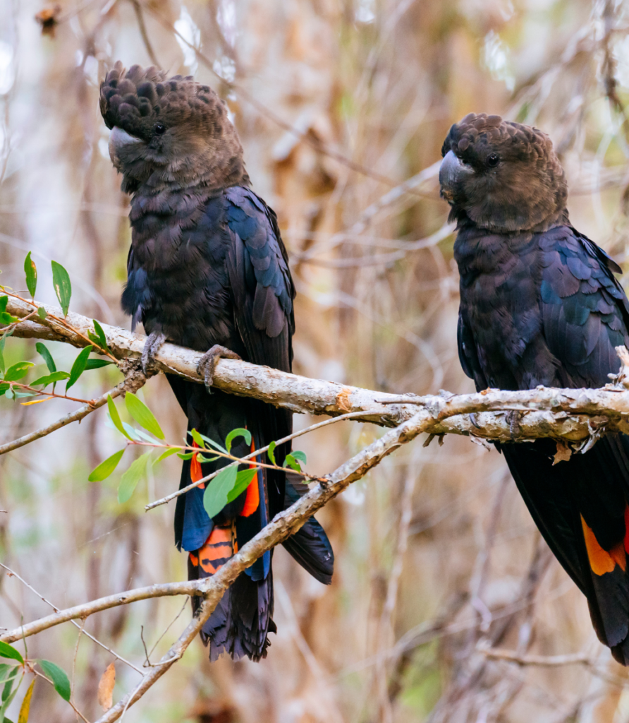
There are a range of vegetation types in both the One Tree West and East biodiversity sites which are in excellent condition and support habitats for threatened animal species, such as the Glossy Black Cockatoo (Calyptorhynchus lathami), Gang-gang Cockatoo (Callocephalon fimbriatum) and Little Lorikeet (Glossopsitta pusilla). These sites are also contiguous with the important Jervis Bay Marine Park marine conservation area (Jervis Bay Habitat Protection Zone).